Tuesday, October 20, 2009

Lake Effect Snow

Lake Effect Snow

Lake effect snow is a weather event that is very common in Northwestern New York. It occurs when a cold, dry air mass, usually from Canada, moves over a warm, wet body of water. The air absorbs moisture from the water. As the clouds move downwind and onto land, the moisture is emptied as snow.

(A map of average snowfall in New York)


In New York, these air masses come from Canada, move across the Great Lakes, and dump huge amounts of snow on cities such as Rochester and Buffalo, giving them more snowfall then almost any other place in the country.

(incredible amounts of snow in Northwestern New York)


Sources:
Earth Science, Tenth Edition
Picture Sources:
Pic #1: www.erh.noaa.gov/er/buf/lakeffect/snwseas.gif
Pic #2: http://www.jeffsweather.com/archives/2007/02/lake_effect_sno_2.html


Record Highest and Lowest Temperatures for Albany, Minneapolis, and Las Vegas

Record highest and lowest temperatures for Albany, Minneapolis, and Las Vegas:

Albany--> High: 104° F (July and September of 1953) Low: -28° F (January of 1971)

Minneapolis--> High: 108° F (July of 1936) Low: -34° F (January of 1970)

Las Vegas--> High: 121° F (July of 1972) Low: 0° F (January of 1963)

Sources:


Ice Storm

Ice Storms are very dangerous and can cause much damage and danger to the areas that they hit. Ice Storms are called such because of the large amount of freezing rain that fall from the sky to create them.
The weight of ice on the tree causes it to wilt.
They do not occur frequently because precise weather conditions are needed to form them. The storms can sometimes start with a top layer of snow that melts and drips onto something less than 32E°F and then begins to freeze again. When this happens it is very dngerous because the weight on powerlines, trees, ect. can cause them to collapse.
Thick coats of ice cover cars and streets after ice storms.

Sources

http://www.ci.savannah.ga.us/cityweb/disasterinfo.nsf/5ae9bd7c8938f28a85256b88006d8e15/973ecbe69ed086d585256c2400535911?OpenDocument

http://farm2.static.flickr.com/1136/1119033982_42e2495b09.jpg

http://everydaycelebrations.files.wordpress.com/2009/05/ice-storm.jpg

Fog

Fog covering a city overhead.

Most people think of fog as a cloud low to the ground that impairs our visibility, but it is actually more complex than you would think. Fog is made up of condensed droplets of water suspended in the air to create a cloud like appearance. However, fog is more common during Autumn nights or dawn. Fog is caused by water droplets from cooled air that can no longer be held (within the air) and are released into the atmosphere.


Fog can have a variety of altitudes from very low to the ground to the as high as the tops of skyscrapers.

Information:

http://www.google.com/search?hl=en&defl=en&q=define:fog&ei=wTzeSoTkE5GZIAelzImoAw&sa=X&oi=glossary_definition&ct=title&ved=0CAsQkAE

http://www.weatherquestions.com/What_causes_fog.htm

http://www.farmersalmanac.com/weather/a/fog_facts

Pictures:

http://images2.sina.com/english/china/p/2009/0211/U102P200T1D217795F10DT20090211182505.jpg First picture

http://www.stuffintheair.com/images/fog.jpg Second picture

Nor'Easter

A nor'easter is a fierce storm. It occurs when a low pressure system from the south Atlantic moves up the east coast and meets with a high pressure system, from the north, arctic area. It brings high winds, rain, snow, and may cause severe damage.

Some areas receive this amount of snow, depending on how hard the storm has hit. Some places receive more or less snow.

The winds are northeasterly. Some wind speeds are greater than those of hurricanes! Features from tropical storms can appear in nor'easters. They are most common during the winter, but nor'easters can occur anytime of year.
This an example of damage that can occur during a nor'easter, especially for someone living near the coast. This occured when large waves crashed upon the shore due to the high winds of the storm.


"Picture a giant, wet Frisbee spinning counterclockwise as it flies north along the Atlantic Coast and you'll see the movement of a nor'easter." (http://www3.cet.edu/weather2/h17.html)

Picture Sources:

http://www.bhsonline.org/teachers/prodanas/weather/78bliz12.jpg

http://msnbcmedia1.msn.com/j/msnbc/Components/Photos/070417/070417_noreaster_hmed_1030a.h2.jpg

Information Sources:

http://www.weather.com/encyclopedia/winter/noreast.html

http://www3.cet.edu/weather2/h17.html

http://www.howstuffworks.com/question595.htm


Wind Chill

This is a picture of a wind chill index chart as of 2001.

Wind chill is how cold it will feel outside for people and animals when they are outside. Wind chill is the heat loss from wind and cold on your skin. When the wind increases it will make you feel colder because it will draw heat from the body.

  • http://www.crh.noaa.gov/images/apx/windchill.gif
  • http://www.mountwashington.org/weather/wind-chill.php
  • http://www.nws.noaa.gov/om/windchill/windchillglossary.shtml

El Nino

El Nino can be shown as a measurement tool to measure the temperature of ocean water. Also, an el nino is the warming of different parts of the ocean. The opposite of this is la nina. This is the cooling of the ocean water. An el nino usually takes place in the pacific ocean.

These two pictures are examples of an el nino. The red and white represent high temperatures and the blue and purple resemble the low temperatures.


When the temperatures are warmer, this has a postitive effect on fishers because when the temperature is warmer the bigger the fish population.

Sources:

-http://www.pmel.noaa.gov/toa/elnino/el-nino-story.html

-http://www.weathersa.co.za/Refrences/elnino_ENSO2.jpg

-http://www.woodrow.org/teachers/esi/1997/02/UOPtorch/S_Digby/ElNino_p49380.jpg


Thunder


LIGHTNING IN AUSTRALIA


When a lightning bolt flashes through the sky we see it instantly. The sound of the lightning, thunder, takes a few seconds, as light travels much faster than sound. Lightning heats air much hotter than the surface of the sun, the temperature gets to be about 36,032 degrees Fahrenheit. Quick expansion and contraction of air around lightning makes the air molecules move back and forth, creating sound waves. This creates the sound that we know as thunder. There are different parts of thunder. First you hear a loud "clap" which is followed by several seconds of rumbling.

LIGHTNING STRIKING A FIELD

www.weatheronline.co.uk/.../Why-Thunder-Rumbles.htm

www.weather.com/

www.nws.noaa.gov/


Lenticular Clouds

A lenticular cloud forming over the peak of a mountain.

Lenticular clouds are stationary or slow moving clouds and known also as altocumulus standing lenticularis. As they form in high pressure areas they become lens-shaped. They normally form perpendicular to the direction in which the wind travels, often the wind is at a high speed. Caused by moist air rising over a mountain and wave-like movements in the atmosphere, they are frequently associated with hills and mountains. For hours or even days the clouds appear to hover until the wind or weather changes.

Lenticulars are often saucer shaped.

Bibliography:

1. http://www.crystalinks.com/lenticular.html, (accessed Oct.20, 2009)

2. http://www.thelivingmoon.com/43ancients/02files/Cloud_Images_Lenticular_01.html, (accessed Oct. 20, 2009)

3. http://virtualskies.arc.nasa.gov/weather/tutorial/lenticular.html, (accessed Oct. 20,2009)

4.http://www.wisegeek.com/what-are-lenticular-clouds.htm, (accessed Oct. 20,2009)

Category 5 Hurricanes


This is a category 5 hurricane in the ocean.


Category 5 hurricanes are one of weather's most hazardous elements. These hurricanes consist of winds exceeding 155 mph and severe damage is expected. Category 5 hurricanes may cause storm surges higher than 18 feet. The complete destruction of small buildings and mobile homes are common. Most trees, signs, and power poles are generally uprooted, snapped, or blown down. Power outages can last weeks to months. Flooding, roof, and structure failures are likely to occur.


Damage from a category 5 hurricane.


Sources:

http://www.nhc.noaa.gov/aboutsshs.shtml


Crepuscular Rays


When clouds and mountain peaks intervene or partially shadow the sun's rays, the light is scattered in a parallel direction throughout open spaces in clouds and other places. These rays are called Crepuscular rays.  You will most commonly see these rays during sunrise, sunset, and dusty or cloudy days. Depending on when you see them they will appear to be coming from different directions. 

Sunset

Example: During sunset the rays will produce a bottom to top or north to south effect.


http://www.allthesky.com/atmosphere/sunrays.htmlhttp://www.demark.org/essays/CrepuscularRays.htmlhttp://www.chitambo.com/clouds/cloudshtml/crepuscular.html 
http://www.astrophys-assist.com/wilobs/weathwin/crepsculr.htm

Monday, October 19, 2009

Blizzard


The results of a blizzard in Brooklyn, 1888

A Blizzard is defined as a severe snow storm with large amounts of snow falling or blowing with dangerous winds that reach over 35 mph.

The destruction caused by a blizzard in October, Buffalo

During a blizzard you shouldn't see over 1/4 of a mile for over three hours and whiteout conditions allow little or no ability to drive or walk. There are great risks of getting frostbite or hypothermia. The ones along the coast can last from 12-24 hours, where snowfall is measured in feet.

Information Sources:

http://www.dosomething.org/tipsandtools/11-facts-about-blizzards#

Picture Sources:

http://upload.wikimedia.org/wikipedia/commons/thumb/2/29/Brooklyn_blizzard_1888.jpg/800px-Brooklyn_blizzard_1888.jpg

http://www.nightflax.com/images/010-IMAG0101.JPG

Three Top Precautions for Hurricanes and Tornadoes


Hurricanes

You should have:

  1. First aid kit, remember any medications.
  2. At least two weeks of food and two gallons of water per person plus more for cooking.
  3. Also have evacuation plans.

After hurricane Ike

Tornadoes

What to do:

  1. Go to a safe location in the basement or a room in the middle of the house.
  2. If you are outside and there is no time to get to a secure location find a ditch and lie face down and cover your head.
  3. Always have a first aid kit handy in such occasions.

After a tornado

Sources:

http://www.bellaonline.com/articles/art35693.asp

http://www.nstmop.psu.edu/tasksheets/2.5.3%20Lightning,Tornadoes%20and%20Rain.pdf


Lightning

(Lightning Strike in Florida)


Lightning is a flash of light that occurs when electrons flow between oppositely charged areas of a cloud, or from areas of negative to positive charge between Cumulonimbus clouds and the ground. Thunder occurs after lightning due to the rapid heating and cooling of the air and change of pressure around the bolt of lightning which causes a sonic crash of sound. The temperature around lightning can become as high as 54,000 degrees Fahrenheit.


(Notice how the lightning is depicted as traveling from negative to positively charged areas in the clouds and on the ground)


information sources: Page 667, Earth Science Tenth Edition, http://en.wikipedia.org/wiki/Lightning

photo sources: http://z.about.com/d/goflorida/1/0/h/K/lightning.jpeg,
http://ffden2.phys.uaf.edu/212_fall2003.web.dir/Shawna_Sastamoinen/types_files/image004.gif

Sunday, October 18, 2009

F5 Tornadoes

F5 Tornado in Canada

An F5 tornado is in category five of the Fujita scale, the deadliest ranking for a tornado. The wind speed range of this phenomena is 261-318 miles per hour. Tornadoes of this strength can lift well-constructed houses off their foundations, strip the bark off of trees, and fling objects over 300 ft. The most deadly tornado in the US was the Tri-State Tornado on march 18, 1925, in Missouri.


Aerial View of an F5 Tornado


Picture Sources:
http://images.google.com/imgres?imgurl=http://www.ec.gc.ca/Envirozine/70BF6FA1-A995-4AE2-9C23-528694E329D6/tornado_l.jpg&imgrefurl=http://www.ec.gc.ca/Envirozine/default.asp%3Flang%3DEn%26n%3D70BF6FA1-1&usg=__YVx1f8DiwPC6575glTqMIZOkKN4=&h=800&w=600&sz=111&hl=en&start=3&sig2=Jk1sqflPmSyJLxm9tCiV5Q&tbnid=yPEK4D10WgWkYM:&tbnh=143&tbnw=107&prev=/images%3Fq%3Df5%2Btornadoes%26gbv%3D2%26hl%3Den%26sa%3DX&ei=ckreSoPPMobcNoGSmfUN

http://scopeweb.mit.edu/wp-content/uploads/2008/03/800px-hurricane_rita_peak.jpg


Information Sources:
http://www.tornadoproject.com/fscale/fscale.htm

http://www.crh.noaa.gov/dtx/1953beecher/

http://www.tornadoproject.com/toptens/1.htm#top


Mammatus clouds

Mammatus clouds during a sunset/sunrise.


Mammatus clouds usually indicate when a strong storm is coming or even a tornado. These clouds are also called mammatocumulus, meaning "Mammary cloud" or "breast cloud." They are normally a bluish gray color or when there is a sunset the clouds look a gold or a reddish cast.

These are mammatus clouds showing that a storm is coming.


These clouds appear more often during warm months over the Midwest and eastern parts of the U.S.. But, most frequently over the west and southwest. Very common for this type of cloud is when they produce wind shear and possibly ball lightning.
Information:
Pictures:

Cirrus Clouds


Cirrus Clouds


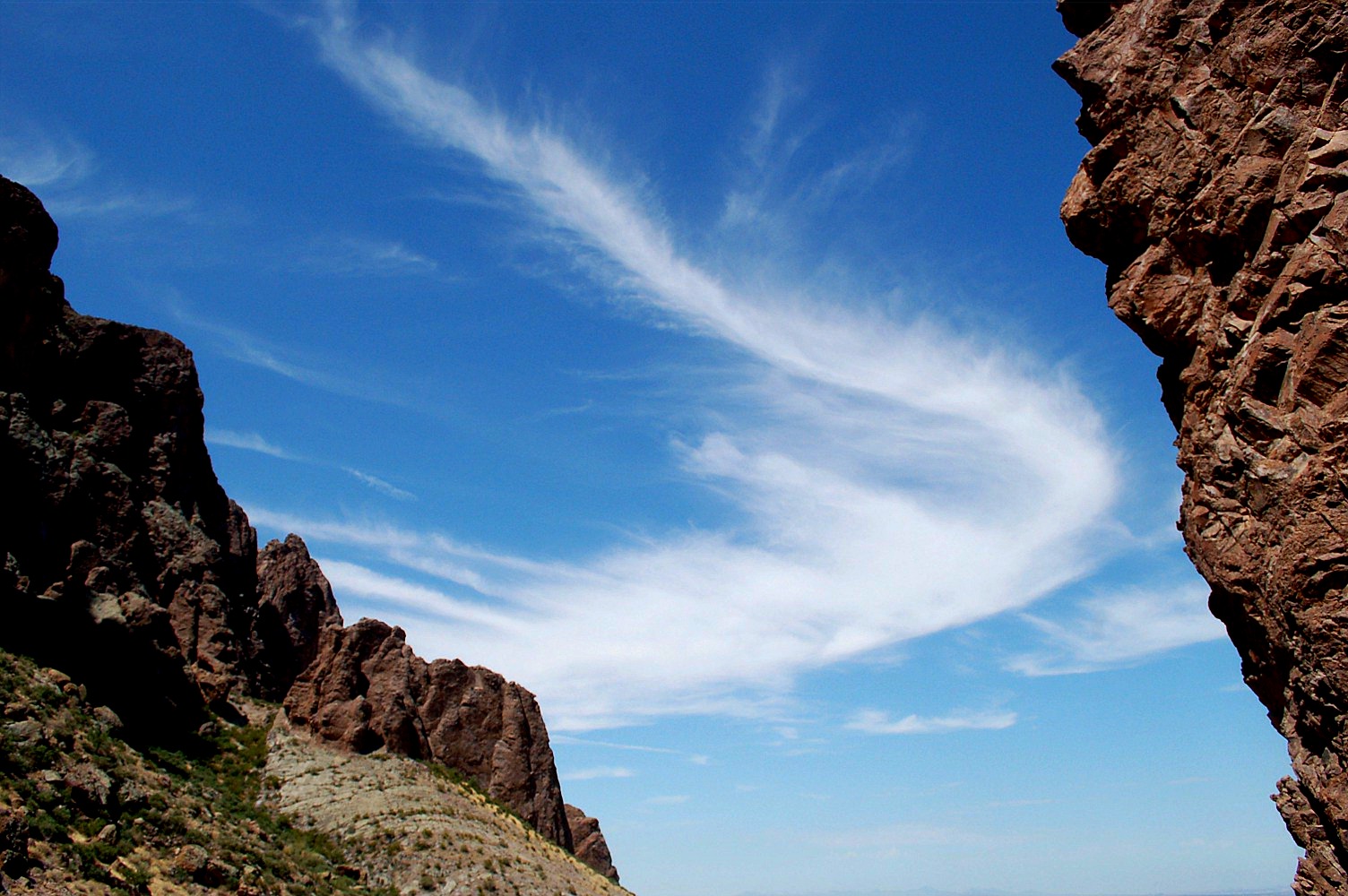
Cirrus clouds over mountain peaks.


Information:
Cirrus clouds usually form at an elevation of 20,000 ft or more. These clouds are composed of ice crystals. They appear during fair weather and look like thin, wispy brush strokes in the sky. They are usually thin because there is little water vapor in that level of the atmosphere. Cirrus clouds are usually blown towards the east by westerly winds. Usually cirrus clouds mean that there is a warm front coming to an area.

Cirrus clouds over the Caribbean.


Sources:


Photos: http://www.edupic.net/Images/Science/cirrus_clouds651.JPG and http://www.gavinhowarthblog.com/wp-content/uploads/2009/08/8135490.jpg


Information: http://ww2010.atmos.uiuc.edu/(Gh)/guides/mtr/cld/cldtyp/hgh/crs.rxml and http://www.usatoday.com/weather/wcirrus.htm

Friday, October 16, 2009

Average Precipitation and Snowfall of Three Citys in New York and Wettest and Driest locations in U.S.

The Average Precipitation and Snowfall of Albany,NY is: Precipitation:36.17in. Snowfall:63.9 in.

The Average Precipitation and Snowfall of New York City is:Precipitation:49.7in. Snowfall:22.7in.

The Average Precipitation and Snowfall of Oswego,NY is:Precipitation:42.7in. Snowfall:153.3in.

Wettest Location in the United States: Mt. Waialeale on Kaiau, Hawaii percipitation:460 in. annually

Driest Location in the United States: Death Valley, California percipitation: 1.84in. annually


http://www.desertusa.com/dv/du_dvpmap.html - driest place

http://www.currentresults.com/Weather-Extremes/US/wettest.php- wettest place

http://www.relohomesearch.com/USA/NY/OSWEGO.aspx - Oswego Percipitation

http://www.123syracuse.com/snowycities.html - Oswego Snowfall

http://lwf.ncdc.noaa.gov/oa/climate/online/ccd/snowfall.html - NYC and Albany Snowfall

http://www.met.utah.edu/jhorel/html/wx/climate/normrain.html -NYC, Albany Precipitation